19 SCOTT DRIVE
Owner Information
ANESTAM EMIL C. & SARAH C. TRUSTEES
19 SCOTT DRIVE
NORTH EASTON, MA 02356


Property Details
19 SCOTT DRIVE is classified as a Single Family Residential (Colonial).
The primary structure on this property was built in 1973. There are 3,232ft2 of built area within this property. There is 2,102ft2 of residential/living space within this property. This property is listed as having 8 rooms.
19 SCOTT DRIVE is valued at $462,200. The land is valued at $261,700 and the structures are valued at $194,700. There is an additional valuation of $5,800 on this property.
This property is in Zone RES. Confirm with local Zoning Board authorities to ensure there are no overlays or other easements on this property.
The most recent deed for 19 SCOTT DRIVE is recorded at the local registrar in Book 26660, Page 75. 19 SCOTT DRIVE was last sold on Wednesday, January 20, 2021 for $1.
Assessment data from fiscal year 2022.
Flood Data
This property is partially within the A Zone (within floodplain). Approximately 0.08 acres (10.46%) of the property is within this zone.
This information is sourced from the FEMA National Flood Hazard Layer. See our full disclamer.
Broadband Internet Providers
| Provider | Type | Bandwidth (mbps) | |
|---|---|---|---|
| Comcast | Cable | 1000 | 35 |
| Viasat Inc | Satellite | 100 | 3 |
| VSAT Systems, LLC. | Satellite | 2 | 1 |
| HughesNet | Satellite | 25 | 3 |
| GCI Communication Corp. | Satellite | 0 | 0 |
| T-Mobile | Fixed Wireless | 25 | 3 |
| Verizon New England Inc. | Fiber | 940 | 880 |
Broadband service provider data from December 2020.
Adjacent Properties
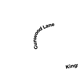
- 24 KINGSBROOK WAY
Single Family Residential owned by PETERSON ROBERT E & JANE F - 18 KINGSBROOK WAY
Single Family Residential owned by HAIMSON JENNIFER R & CRAIG R TRUSTEE - 5 CLAIR ROAD
Single Family Residential owned by STUDHOLME DAVID P & KAREN L - 9 CLAIR ROAD
Single Family Residential owned by HERN JAMES L & EDWINA R - 30 KINGSBROOK WAY
Single Family Residential owned by MALIN GLENN E. & JERI E. TRUSTEES